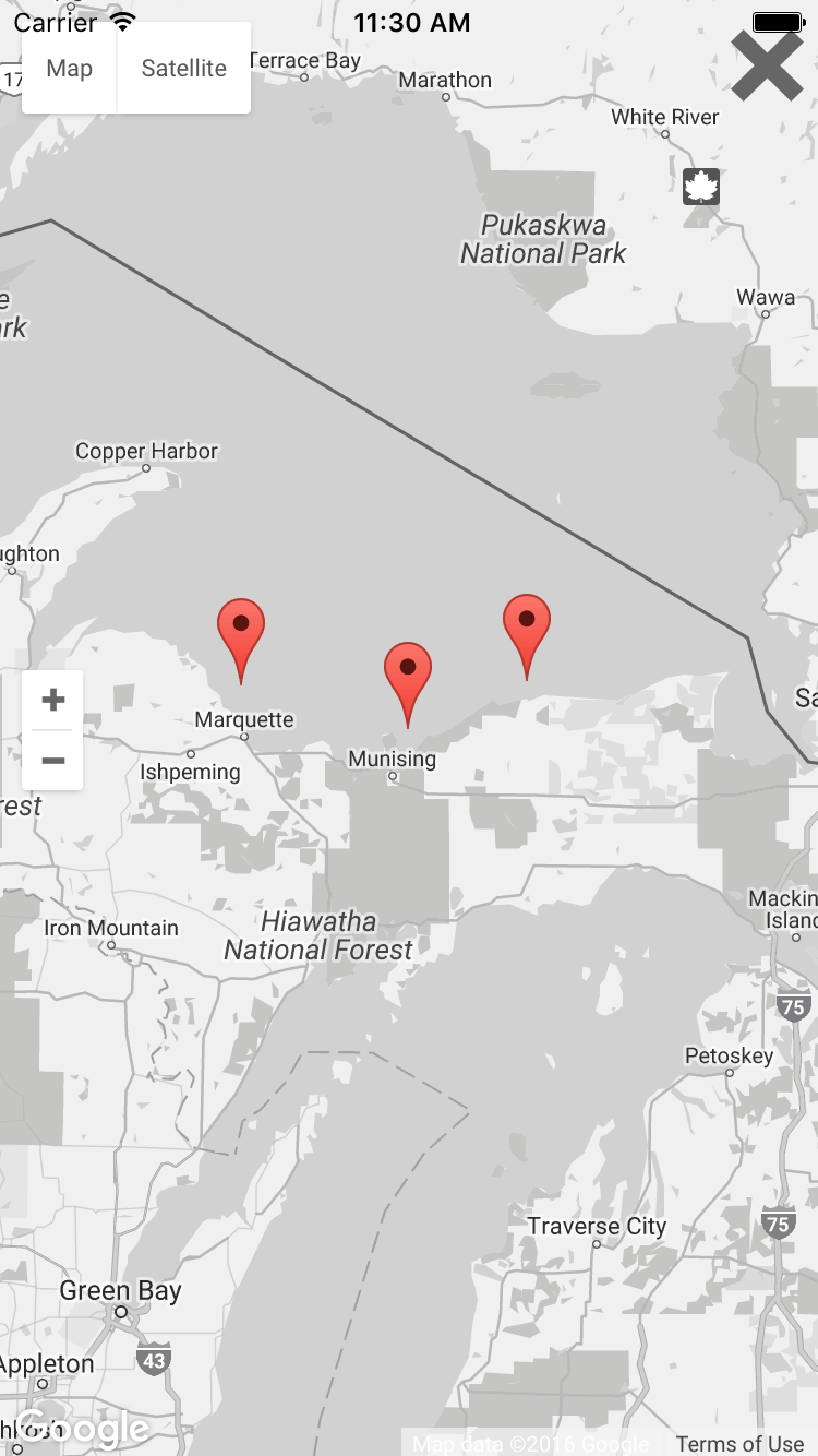
The Lake Superior coastline is rugged, wild, and notorious for shipwrecks that attest to the combined dangers of water, wind, and waves. Until recently, the 185-mile (300-km) section of shoreline from the Huron Islands to Whitefish Point was without any modern offshore equipment to provide critical coastal storm data such as wave height and water temperature.
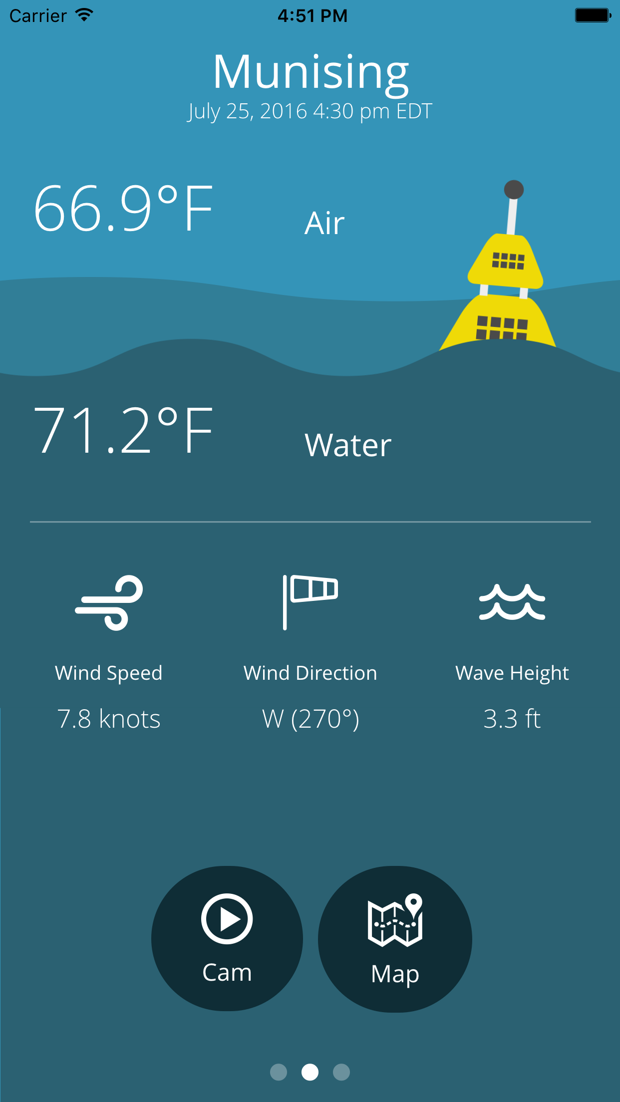
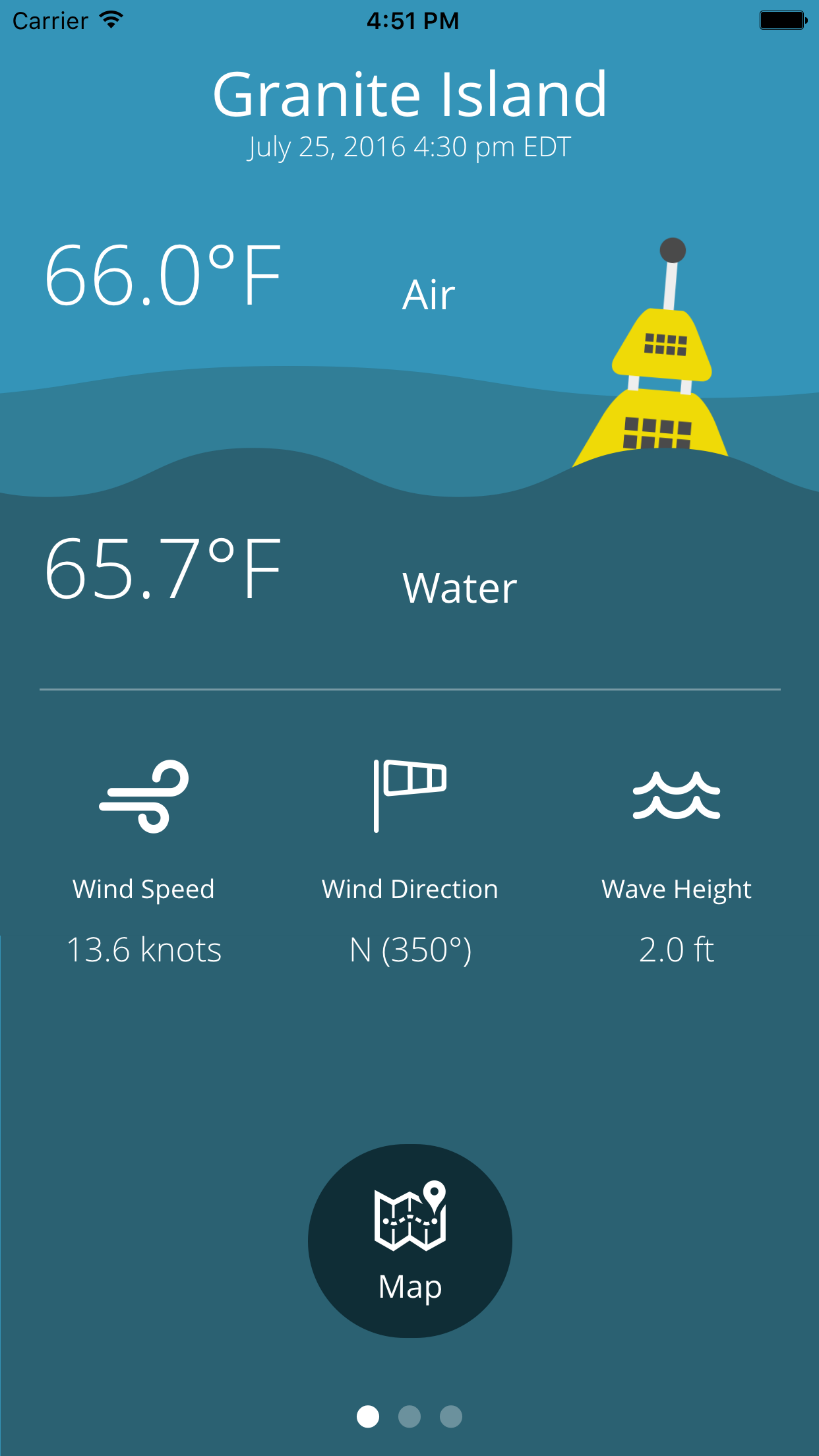
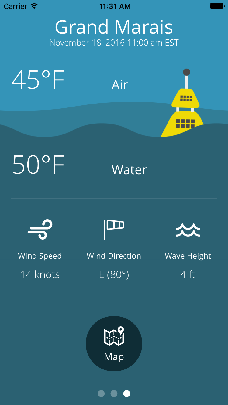
In 2014, Northern Michigan University – in cooperation with LimnoTech and the Superior Watershed Partnership – received funding from the Great Lakes Observing System to deploy a number of coastal storm buoys along the southeastern shoreline of Lake Superior. The three buoys are located 5-10 miles offshore of Marquette, Munising, and Grand Marais, providing real-time wave height, water temperature, and meteorological data.


 Sunny
Sunny Shiny
Shiny Cloudy
 Rainy
Rainy Stormy
 Snowy
Snowy